
Denton County ZIP Code Directory
This Denton County ZIP code directory uses the complete 42-code research inventory of labels that appear within or partly within the county. It is a working verification list, not a USPS-certified boundary file. The postal city in the table is the common label found in Denton-area records, while the notes flag partial, edge, and PO Box situations. Check a specific street address with USPS before deciding that a code applies to a parcel or a household.
| ZIP | Common postal-city label | County or delivery note |
|---|---|---|
| 75007 | Carrollton | Cross-boundary or partial, verify address |
| 75009 | Celina | Edge or partial, verify address |
| 75010 | Carrollton | Cross-boundary or partial |
| 75022 | Flower Mound | Partial or edge |
| 75027 | Flower Mound | PO Box or municipal-label variation, verify |
| 75028 | Flower Mound | Partial or edge |
| 75029 | Lewisville | PO Box or edge label |
| 75033 | Frisco | Edge or partial |
| 75034 | Frisco | Edge or partial |
| 75036 | Frisco | Edge or partial |
| 75056 | The Colony | Partial or edge |
| 75057 | Lewisville | Partial or edge |
| 75065 | Lake Dallas | Partial or edge |
| 75067 | Lewisville | Partial or edge |
| 75068 | Little Elm | Partial or edge |
| 75077 | Lewisville | Partial or edge |
| 75078 | Prosper | Edge or partial |
| 75093 | Plano | Edge or partial |
| 75287 | Dallas | Edge or partial, label is not county or city proof |
| 76052 | Haslet | Southern or western edge |
| 76092 | Southlake | Southern or eastern edge |
| 76177 | Fort Worth | Southern or western edge |
| 76201 | Denton | Core Denton label |
| 76202 | Denton | PO Box or central Denton label |
| 76203 | Denton | PO Box or central Denton label |
| 76204 | Denton | PO Box or central Denton label |
| 76205 | Denton | Core or partial Denton label |
| 76206 | Denton | PO Box or central Denton label |
| 76207 | Denton | Core or partial Denton label |
| 76208 | Denton | Core or partial Denton label |
| 76209 | Denton | Core or partial Denton label |
| 76210 | Denton | Core or partial Denton label |
| 76226 | Argyle | Partial or edge |
| 76227 | Aubrey | Partial or edge |
| 76234 | Decatur | Northern or western edge |
| 76247 | Justin | Partial or edge |
| 76249 | Krum | Partial or edge |
| 76258 | Pilot Point | Partial or edge |
| 76259 | Ponder | Partial or edge |
| 76262 | Roanoke | Partial or edge |
| 76266 | Sanger | Partial or edge |
| 76272 | Valley View | Northern edge |
The inventory is deliberately broad because ZIPs cross municipal and county edges. It should narrow a verification task, never serve as a claim that every address under a label falls inside Denton County.
Denton County ZIP Code Geography
A USPS ZIP Code is built for delivery. It is not a city limit, county line, subdivision, or parcel boundary. The Census explanation of ZIP Code Tabulation Areas makes the difference clear: a ZCTA is a generalized statistical area, while ZIP Codes are USPS delivery routes. Either can cross municipal or county lines, and some ZIPs are PO Box-only, unique to a receiving point, or noncontiguous.
This distinction matters across Denton County's edges. A postal label such as Carrollton, Frisco, Lewisville, or Denton may coexist with a different incorporated municipality or another county context. Preserve the label supplied by each source. A parcel record can be in one municipal layer while USPS returns a preferred postal city with another name. Neither source needs to be silently corrected.
- ZIP and ZIP+4
- The five-digit delivery area and the added four digits used to sort a more specific delivery segment.
- PO Box ZIP
- A code assigned for post office box delivery that may not match a street-delivery code.
- Unique ZIP
- A ZIP used for a single large receiving location or organization rather than a normal neighborhood area.
- Carrier route
- A delivery route used for mail sorting, not a civic or parcel boundary.
Denton County ZIP Code Checks
Use an address-first sequence for a Denton County ZIP code search. Start with USPS, then compare the result with property and map sources. This separates a delivery label from a parcel's situs, which is the actual property location. It also creates a clear record when a postal city, municipality, or county label does not match another source.
- Enter the complete street address in the USPS ZIP Code Lookup and record the address format, returned ZIP, postal city, and date checked.
- Search the same location in Denton County TaxWeb using the property-location route, not the owner mailing-address route.
- Compare the situs and legal description with DCAD and the Denton County GIS parcel and municipal layers.
- Keep USPS ZIP, postal city, GIS municipality, parcel county, and ZCTA in separate fields when they differ.
The USPS address-to-ZIP tool is the first verification screen in that sequence.
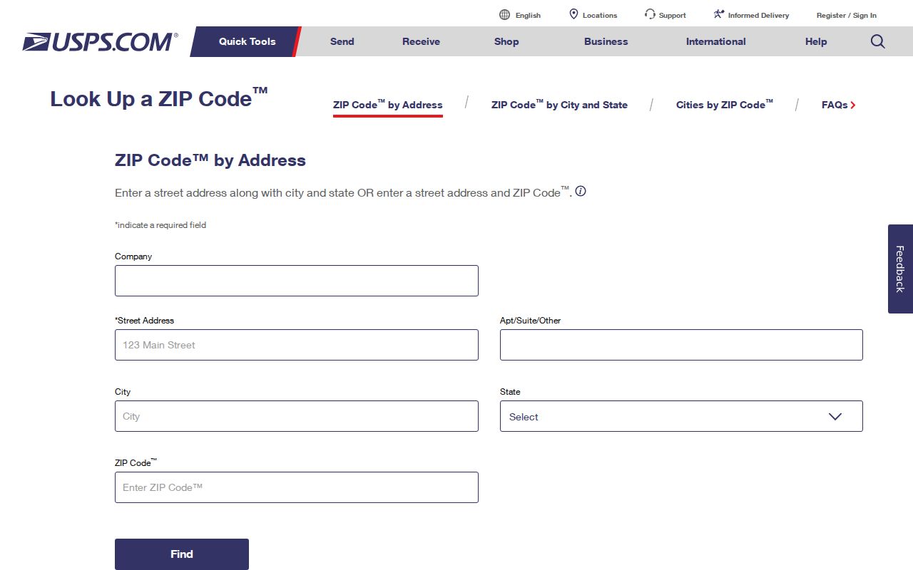
The returned delivery label should be saved with the exact address and access date, not treated as a parcel-boundary decision.
Once a ZIP is narrowed to a specific street, the Denton County street directory provides the address-level record path.
Denton County ZIP Code Limits
TaxWeb helps compare a local property location with an owner mailing address, but it does not offer a verified countywide ZIP filter. Its visible interface separates owner name, owner address, and property location, along with account type, active or inactive accounts, and paid or unpaid status. For owner name, the help text specifies a last-first format. For property location, it calls for a number and street name without street type or direction.
| TaxWeb control | Use in ZIP verification |
|---|---|
| Owner address | Mailing context only, not the property location |
| Property location | Actual situs check by street number and name |
| Account type | Limits the record set being searched |
| Active or inactive | Changes account status scope |
| Paid or unpaid | Tax-status context, not a ZIP filter |
| ZIP selector | No verified selector was present in the researched interface |
The Denton County TaxWeb search shows the owner-address and property-location distinction used for this comparison.
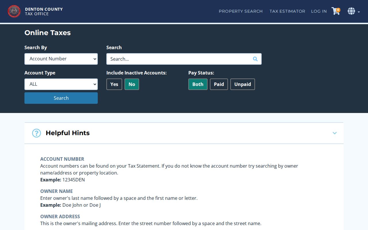
The screen supports an address check, while the absence of a verified ZIP field prevents a claim that it can search the entire county by ZIP.
Denton County ZIP Voter Requests
Texas has separate rules for an individual voter portal and an official voter-file request. The current My Voter Portal could not be inspected during research, so its live labels, required fields, and address behavior should not be guessed. The SOS public voter-file request form is a defined request process, not a generic ZIP lookup. It allows scope and reduction choices such as county or district, status, mailing-address criteria, registration date range, age range, sex, and election participation filters. The file layout includes permanent and mailing ZIP fields.
That form also carries an affidavit, a deposit, fees, delivery choices, and lawful-use terms. Use the SOS voter-data request form for its current instructions, and use Denton County Elections for precinct and local administration questions. A public voter category does not override residence-address suppression or other confidentiality rules.
Denton County ZIP Boundary Limits
A postal city, municipal city, parcel county, and ZCTA can all be true source values for one address while describing different systems. Common mismatch causes include an edge ZIP, a PO Box label, annexation, new development, a rural route, or an address that crosses into Collin, Dallas, Tarrant, Cooke, Wise, or another adjacent county. A ZIP-only match is not an identity match and does not prove county residence.
Keep the mismatch visible. Record the USPS postal city and ZIP beside the GIS municipality and parcel county. That preserves the source trail instead of making a quiet assumption about an address.
Note: GIS and Census layers can help inspect ZCTA overlap, but neither should be treated as the USPS delivery decision for a particular mailbox.
Denton County ZIP Directory Fields
For a repeatable Denton County ZIP code directory entry, keep each geography field separate. A short inventory makes source conflicts useful rather than confusing. It also makes later verification possible when postal assignments or local parcel data change.
| Field to retain | Reason |
|---|---|
| Street address | The exact address submitted to a delivery or local-record system |
| USPS-verified ZIP and postal city | Delivery result with the date checked |
| County GIS municipality | Local map and jurisdiction context |
| Parcel county and situs | Property-record identity |
| ZCTA, if used | Statistical geography, clearly labeled as such |
| Mismatch note | Explains conflicting labels without overwriting them |
That approach is especially useful for the broad edge codes in the 42-code list, where the address, not the label alone, controls the correct next record search.
Denton County ZIP Code Dates
Postal and parcel information should always carry an access date. The 42-code table is a research working inventory that was cross-checked against a county-border ZIP inventory, but that inventory is not an official government source and is not used as final boundary proof. The research could not obtain one complete official USPS countywide list or map as an extractable table. That limitation is why an address-by-address USPS result remains the first delivery check.
Keep the date for the USPS response alongside the date for TaxWeb, DCAD, or the GIS layer. DCAD reports that parcel geometry is updated or exported weekly, and owner information can lag during annual notification and review activity. A later postal answer and an earlier parcel result can both be accurately recorded when their source dates are clear. The Census ZCTA guidance supplies a separate statistical-geography reference, not a replacement for a USPS delivery check.
When a source returns a postal label that looks unexpected, retain it and run the same address through the local parcel route before making a correction. The useful result is often a documented mismatch: one field for USPS delivery, one for parcel situs, one for the GIS municipality, and one for the county. That record can be checked again later if a route, development, or local data update changes a displayed label.